![]()
| Corsica, France | Mare a Mare Nord | 2002.10.04 - 10.07 |
North Sea to Sea Trek
Corsica has the difficult 15-day north-south trek called the Grand Randonnée 20 (GR20). Hikers looking for shorter and easier treks have the choice of 3 Mare a Mare routes (Nord, Centre, Sud) and 2 Mare e Monti routes (Nord, Sud). The Mare a Mare routes traverse Corsica East-West to/from the Mediterranean Sea on either side. The Mare e Monti routes start from one Mediterranean coast, ascend into the central mountains, and return to the same coast at a different location. Each of these 5 trails are easier hikes, have more comfortable facilities, and range from 5 to 10 days to complete. Since the routes intersect, you can plan your own walk, short or long, easy or difficult, with the assistance of IGN topographical maps.
OUR MARE A MARE NORD TREK
We chose a 3-day route from Ota to Albertacce that was 1 day on the Mare e Monti Nord
trail from Ota to Evisa, 1 day on the Mare a Mare Nord trail from Evisa to
Col de Vergio, and 1 day on the GR20 from Col de Vergio to Bergeries de Ballone plus
a descent to Albertacce. Generally, we followed the direction of the standard
Mare a Mare Nord route, but added the lengthy GR20 detour because Lonely Planet
specified this section of the GR20 as one of 6 highlights along the GR20.
The GR20 segment we walked was physically more difficult than either section of the
Mare e Monti Nord or Mare a Mare Nord we covered. Also, the GR20 wasn't any more
beautiful than the easier routes. Unless you have a dying urge to walk to most
strenuous trails, we recommend compiling your own itinerary through easier courses
with more comfortable accommodation as we did.
MAPS
2 maps cover the entire Mare a Mare Nord trail and its surroundings. We used IGN topographical
map numbers 4150 OT titled "PORTO CANLANCHE DE PIANA" and 4250 OT titled
"CORTE MONTE CINTO". Maps cost €9 each and are available in any city on
Corsica.
GETTING TO AND FROM THE TREK
Public transportation through the mountains is limited in high season (mid May - mid September).
In low season, many bus routes stop. Record bus and train schedules before departure
to ensure you have a way to return to civilization. Both bus and train schedules are
available at train stations in cities. Find the bus schedules taped to a door or wall.
Tourist information offices are little help when requesting public transportation schedules
that don't originate or terminate in their city. In the worst case, you always have the
option of hitchhiking. We had to hitch to get from Albertacce to a town with a train station.
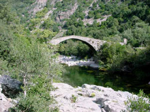 |
The stone Ponte Vecchiu bridge crossed the Porto River just before the Ota-Evisa trail ascends up the Garges Spelunca. |
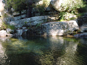 |
Between Evisa and Col de Vergio (Vergio Pass) is an area of natural pools called Piscine Naturelle d'Aitone. |
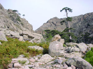 |
The Mare e Mare Nord trail intersects the 15-day long Grand Randonnée 20 trail that runs north-south through Corsica. We sidetracked for 7 hours to walk one segment of the GR20. |
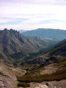 |
Looking down the east side of the GR20, we see a lake and the town of Albertacce where we stay overnight. |
Copyright © 2000-2002 Wes and Masami Heiser. All rights reserved.